ߞߐߕߐ߮:Satellite image of Cape Verde in December 2002.jpg

ߊ߬ ߢߍߦߋߟߌ ߢߊ߲ߞߊ߲: ߔߌߞߑߛߍߟ ߆߄߂ × ߆߀߀. ߢߊߓߐߟߌ ߟߎ߬ ߕߐ߬ߡߊ ߔߌߞߑߛߍߟ ߂߅߇ × ߂߄߀ | ߔߌߞߑߛߍߟ ߅߁߄ × ߄߈߀ | ߔߌߞߑߛߍߟ ߈߂߂ × ߇߆߈ | ߔߌߞߑߛߍߟ ߁,߁߈߉ × ߁,߁߁߁.
ߞߐߕߐ߮ ߓߊߛߎ߲ (߁,߁߈߉ × ߁,߁߁߁ ߖߌ߬ߦߊ߬ߘߊ߲ߕߊ߸ ߞߐߕߐ߮ ߢߊ߲ߞߊ߲: ߄߈߅ KB߸ MIME ߛߎ߮ߦߊ:image/jpeg)
| ߕߐ߯ߟߊߘߏ߲ |
Español: Imagen satélite de las islas de Cabo Verde
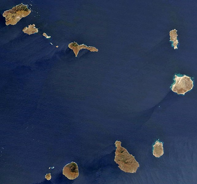
English: satellite image of the Cape Verde Islands
Português: imagem de satélite das ilhas de Cabo Verde |
|||||
| ߕߎ߬ߡߊ߬ߘߊ | ||||||
| ߛߎ߲ | Cropped image, original taken from NASA's Visible Earth http://visibleearth.nasa.gov/view_rec.php?id=4638 | |||||
| ߛߓߍߦߟߊ | NASA's Visible Earth | |||||
| ߘߌ߬ߢߍ߬ߟߊ߬ߢߌ߬ߣߌ߲߬ (ߞߐߕߐ߮ ߣߌ߲߬ ߠߊߓߊ߯ߙߊ߫ ߕߎ߲߯) |
|

ߞߐߕߐ߮ ߟߊ߫ ߘߐ߬ߝߐ
ߕߎ߬ߡߊ߬ߘߊ/ߕߎ߬ߡߊ ߛߐ߲߬ߞߌ߲߬ ߓߊ߫߸ ߞߊ߬ ߕߎ߬ߡߊ߬ߘߊ ߞߐߕߐ߮ ߟߎ߬ ߦߋ߫.
| ߕߎ߬ߡߊ߬ߘߊ/ߕߎ߬ߡߊ߬ߟߊ߲ | ߞߝߊ߬ߟߋ߲ߛߋ߲ | ߛߎߡߊ߲ߘߐ | ߟߊ߬ߓߊ߰ߙߊ߬ߟߊ | ߞߊ߲߬ߝߐߟߌ | |
|---|---|---|---|---|---|
| ߞߍߛߊ߲ߞߏ | ߁߄:߂߄, ߁߈ ߞߏ߲ߓߌߕߌ߮ ߂߀߀߈ | | ߁,߁߈߉ × ߁,߁߁߁ (߄߈߅ KB) | Waldyrious | Reverted to previous version (with consent of the latest version's uploader, see http://commons.wikimedia.org/w/index.php?title=User_talk:JavierMC&diff=15295109&oldid=15294283 ) |
| ߀߁:߁߂, ߁߆ ߞߏ߲ߓߌߕߌ߮ ߂߀߀߈ |  | ߁,߁߇߀ × ߁,߀߉߄ (߇߈߂ KB) | JavierMC | reduce noise using FFT-iFFT filter and adjust levels for clarity | |
| ߁߇:߄߈, ߆ ߘߓߊ߬ߕߊ ߂߀߀߈ |  | ߁,߁߈߉ × ߁,߁߁߁ (߄߈߅ KB) | Waldyrious | less destructive enhancement | |
| ߁߂:߂߅, ߁߆ ߞߏ߲ߞߏߘߌ߬ߓߌ ߂߀߀߈ |  | ߁,߁߈߉ × ߁,߁߁߁ (߁߄߀ KB) | AVM | Color-enhanced version of previous image | |
| ߁߄:߃߂, ߂߆ ߞߏߟߌ߲ߞߏߟߌ߲ ߂߀߀߄ |  | ߁,߁߈߉ × ߁,߁߁߁ (߇߀ KB) | Hautala | {{PD-USGov-NASA}} Satellite image of Cape Verde in December 2002. Cropped image, original taken from NASA's Visible Earth http://visibleearth.nasa.gov/cgi-bin/viewrecord?23101 |
ߞߐߕߐ߮ ߟߊߓߊ߯ߙߊߟߌ
ߞߐߜߍ 1 ߟߎ߬ ߦߋ߫ ߞߐߕߐ߮ ߣߌ߲߬ ߠߊߓߊ߯ߙߊ߫ ߟߊ߫:
ߞߐߕߐ߮ ߟߊߓߊ߯ߙߊߟߌ߫ ߞߙߎߞߙߍ
ߥߞߌ߫ ߕߐ߭ ߢߌ߲߬ ߠߎ߬ ߦߋ߫ ߞߐߕߐ߮ ߣߌ߲߬ ߠߊߓߊ߯ߙߊ߫ ߟߊ߫:
- ߊ߬ ߟߊߓߊ߯ߙߊ߫ af.wikipedia.org ߘߐ߫
- ߊ߬ ߟߊߓߊ߯ߙߊ߫ ar.wikipedia.org ߘߐ߫
- ߊ߬ ߟߊߓߊ߯ߙߊ߫ arz.wikipedia.org ߘߐ߫
- ߊ߬ ߟߊߓߊ߯ߙߊ߫ ast.wikipedia.org ߘߐ߫
- ߊ߬ ߟߊߓߊ߯ߙߊ߫ ca.wikipedia.org ߘߐ߫
- ߊ߬ ߟߊߓߊ߯ߙߊ߫ ceb.wikipedia.org ߘߐ߫
- ߊ߬ ߟߊߓߊ߯ߙߊ߫ dag.wikipedia.org ߘߐ߫
- ߊ߬ ߟߊߓߊ߯ߙߊ߫ de.wikivoyage.org ߘߐ߫
- ߊ߬ ߟߊߓߊ߯ߙߊ߫ dga.wikipedia.org ߘߐ߫
- ߊ߬ ߟߊߓߊ߯ߙߊ߫ diq.wikipedia.org ߘߐ߫
- ߊ߬ ߟߊߓߊ߯ߙߊ߫ el.wikipedia.org ߘߐ߫
- ߊ߬ ߟߊߓߊ߯ߙߊ߫ en.wikipedia.org ߘߐ߫
- Geography of Cape Verde
- Talk:Community of Portuguese Language Countries
- Talk:Henrik Larsson
- Talk:Aristides Pereira
- Talk:Public holidays in Cape Verde
- Talk:Music of Cape Verde
- Talk:Raso lark
- Talk:African Party for the Independence of Guinea and Cape Verde
- Talk:Patrick Vieira
- Talk:Pico do Fogo
- Talk:Flag of Cape Verde
- Talk:Hurricane Alberto (2000)
- Talk:ECOWAS
- Talk:Hurricane Faith
- Talk:Hurricane Allen
- Talk:Santo Antão, Cape Verde
- Talk:Cape Verdean Americans
- Talk:Fogo, Cape Verde
- Talk:Luso-American
- Talk:1901 Atlantic hurricane season
- Talk:Battle of Porto Praya
- Talk:Cape Verdean escudo
- Talk:Lusitanic
- Talk:Effie M. Morrissey
- Talk:Espargos
- Talk:Eco (currency)
- Talk:Tropical Storm Beryl (1982)
- Talk:Portuguese Colonial War
- Talk:Cape Verde hurricane
- Talk:Cape Verdean real
- Talk:Claridade
- Talk:Associação dos Escuteiros de Cabo Verde
- Talk:.cv
ߞߐߕߐ߮ ߣߌ߲߬ more global usage ߦߋߟߌ.