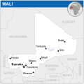
ߞߐߕߐ߮:Mali - Location Map (2013) - MLI - UNOCHA.svg

ߣߌ߲߬ PNG ߢߊ߲ߞߊ߲߸ ߣߌ߲߬ SVG ߢߍߦߋߟߌ߸ ߞߐߕߐ߮: ߔߌߞߑߛߍߟ ߂߅߄ × ߂߅߄ ߢߊߓߐߟߌ ߟߎ߬ ߕߐ߬ߡߊ ߔߌߞߑߛߍߟ ߂߄߀ × ߂߄߀ | ߔߌߞߑߛߍߟ ߄߈߀ × ߄߈߀ | ߔߌߞߑߛߍߟ ߇߆߈ × ߇߆߈ | ߔߌߞߑߛߍߟ ߁,߀߂߄ × ߁,߀߂߄ | ߔߌߞߑߛߍߟ ߂,߀߄߈ × ߂,߀߄߈.
ߞߐߕߐ߮ ߓߊߛߎ߲ (SVG ߞߐߕߐ߮, ߕߐ߯ߦߊߟߌ ߂߅߄ × ߂߅߄ ߖߌ߬ߦߊ߬ߘߊ߲ߕߊ, ߞߐߕߐ߮ ߢߊ߲ߞߊ߲: ߄߀߇ KB)
ߞߐߕߐ߮ ߟߊ߫ ߘߐ߬ߝߐ
ߕߎ߬ߡߊ߬ߘߊ/ߕߎ߬ߡߊ ߛߐ߲߬ߞߌ߲߬ ߓߊ߫߸ ߞߊ߬ ߕߎ߬ߡߊ߬ߘߊ ߞߐߕߐ߮ ߟߎ߬ ߦߋ߫.
| ߕߎ߬ߡߊ߬ߘߊ/ߕߎ߬ߡߊ߬ߟߊ߲ | ߞߝߊ߬ߟߋ߲ߛߋ߲ | ߛߎߡߊ߲ߘߐ | ߟߊ߬ߓߊ߰ߙߊ߬ߟߊ | ߞߊ߲߬ߝߐߟߌ | |
|---|---|---|---|---|---|
| ߞߍߛߊ߲ߞߏ | ߀߁:߄߆, ߂߉ ߕߙߊߓߊ ߂߀߁߅ |  | ߂߅߄ × ߂߅߄ (߄߀߇ KB) | Pharos | update |
| ߀߃:߃߁, ߁߈ ߣߍߣߍߓߊ ߂߀߁߄ |  | ߂߅߄ × ߂߅߄ (߄߀߇ KB) | Pharos | try without logo for now | |
| ߂߃:߅߂, ߇ ߘߓߊ߬ߕߊ ߂߀߁߄ |  | ߂߅߄ × ߂߅߄ (߃߇߆ KB) | UN OCHA maps bot | == {{int:filedesc}} == {{Information |description={{en|1=Locator map of Mali.}} |date=2013 |source={{en|1=[http://reliefweb.int/map/mali/mali-location-map-2013 Mali Locator Map (ReliefWeb)]}} |author={{en|1=[[w:en:United Nations Office fo... |
ߞߐߕߐ߮ ߟߊߓߊ߯ߙߊߟߌ
ߞߐߜߍ 1 ߟߎ߬ ߦߋ߫ ߞߐߕߐ߮ ߣߌ߲߬ ߠߊߓߊ߯ߙߊ߫ ߟߊ߫:
ߞߐߕߐ߮ ߟߊߓߊ߯ߙߊߟߌ߫ ߞߙߎߞߙߍ
ߥߞߌ߫ ߕߐ߭ ߢߌ߲߬ ߠߎ߬ ߦߋ߫ ߞߐߕߐ߮ ߣߌ߲߬ ߠߊߓߊ߯ߙߊ߫ ߟߊ߫:
- ߊ߬ ߟߊߓߊ߯ߙߊ߫ arz.wikipedia.org ߘߐ߫
- ߊ߬ ߟߊߓߊ߯ߙߊ߫ ast.wikipedia.org ߘߐ߫
- ߊ߬ ߟߊߓߊ߯ߙߊ߫ azb.wikipedia.org ߘߐ߫
- ߊ߬ ߟߊߓߊ߯ߙߊ߫ bh.wikipedia.org ߘߐ߫
- ߊ߬ ߟߊߓߊ߯ߙߊ߫ bn.wikipedia.org ߘߐ߫
- ߊ߬ ߟߊߓߊ߯ߙߊ߫ ca.wikipedia.org ߘߐ߫
- ߊ߬ ߟߊߓߊ߯ߙߊ߫ dag.wikipedia.org ߘߐ߫
- ߊ߬ ߟߊߓߊ߯ߙߊ߫ de.wikivoyage.org ߘߐ߫
- ߊ߬ ߟߊߓߊ߯ߙߊ߫ dga.wikipedia.org ߘߐ߫
- ߊ߬ ߟߊߓߊ߯ߙߊ߫ diq.wikipedia.org ߘߐ߫
- ߊ߬ ߟߊߓߊ߯ߙߊ߫ dty.wikipedia.org ߘߐ߫
- ߊ߬ ߟߊߓߊ߯ߙߊ߫ en.wikipedia.org ߘߐ߫
- ߊ߬ ߟߊߓߊ߯ߙߊ߫ eo.wikinews.org ߘߐ߫
- ߊ߬ ߟߊߓߊ߯ߙߊ߫ ff.wikipedia.org ߘߐ߫
- ߊ߬ ߟߊߓߊ߯ߙߊ߫ fi.wikipedia.org ߘߐ߫
- ߊ߬ ߟߊߓߊ߯ߙߊ߫ fr.wikinews.org ߘߐ߫
- ߊ߬ ߟߊߓߊ߯ߙߊ߫ fr.wikivoyage.org ߘߐ߫
- ߊ߬ ߟߊߓߊ߯ߙߊ߫ ga.wikipedia.org ߘߐ߫
- ߊ߬ ߟߊߓߊ߯ߙߊ߫ gd.wikipedia.org ߘߐ߫
- ߊ߬ ߟߊߓߊ߯ߙߊ߫ gl.wikipedia.org ߘߐ߫
- ߊ߬ ߟߊߓߊ߯ߙߊ߫ gpe.wikipedia.org ߘߐ߫
- ߊ߬ ߟߊߓߊ߯ߙߊ߫ gu.wikipedia.org ߘߐ߫
- ߊ߬ ߟߊߓߊ߯ߙߊ߫ ha.wikipedia.org ߘߐ߫
- ߊ߬ ߟߊߓߊ߯ߙߊ߫ he.wikivoyage.org ߘߐ߫
- ߊ߬ ߟߊߓߊ߯ߙߊ߫ hi.wikipedia.org ߘߐ߫
- ߊ߬ ߟߊߓߊ߯ߙߊ߫ ht.wikipedia.org ߘߐ߫
- ߊ߬ ߟߊߓߊ߯ߙߊ߫ ia.wikipedia.org ߘߐ߫
- ߊ߬ ߟߊߓߊ߯ߙߊ߫ id.wikipedia.org ߘߐ߫
- ߊ߬ ߟߊߓߊ߯ߙߊ߫ ig.wikipedia.org ߘߐ߫
- ߊ߬ ߟߊߓߊ߯ߙߊ߫ ilo.wikipedia.org ߘߐ߫
- ߊ߬ ߟߊߓߊ߯ߙߊ߫ incubator.wikimedia.org ߘߐ߫
- ߊ߬ ߟߊߓߊ߯ߙߊ߫ it.wikipedia.org ߘߐ߫
- ߊ߬ ߟߊߓߊ߯ߙߊ߫ kab.wikipedia.org ߘߐ߫
- ߊ߬ ߟߊߓߊ߯ߙߊ߫ mg.wikipedia.org ߘߐ߫
- ߊ߬ ߟߊߓߊ߯ߙߊ߫ mt.wikipedia.org ߘߐ߫
- ߊ߬ ߟߊߓߊ߯ߙߊ߫ ne.wikipedia.org ߘߐ߫
- ߊ߬ ߟߊߓߊ߯ߙߊ߫ pap.wikipedia.org ߘߐ߫
- ߊ߬ ߟߊߓߊ߯ߙߊ߫ pl.wikipedia.org ߘߐ߫
- ߊ߬ ߟߊߓߊ߯ߙߊ߫ rw.wikipedia.org ߘߐ߫
- ߊ߬ ߟߊߓߊ߯ߙߊ߫ sco.wikipedia.org ߘߐ߫
- ߊ߬ ߟߊߓߊ߯ߙߊ߫ sd.wikipedia.org ߘߐ߫
- ߊ߬ ߟߊߓߊ߯ߙߊ߫ te.wikipedia.org ߘߐ߫
- ߊ߬ ߟߊߓߊ߯ߙߊ߫ tl.wikipedia.org ߘߐ߫
ߞߐߕߐ߮ ߣߌ߲߬ more global usage ߦߋߟߌ.
